King Kong
Here are some images of Daniel's work for the film "King Kong", by Peter Jackson. Missing are shots of the ship's logbooks, and various other pieces of lettering. For all that you ever wanted to know (but were too afraid to ask) about the King Kong film, visit http://www.kongisking.net/
|
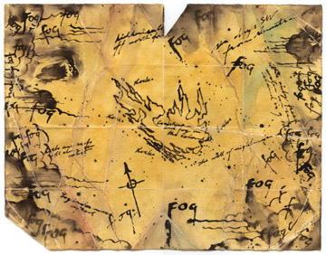
The hand-drawn map of Skull Island, supposedly drawn by a half-crazed Norwegian seaman who survived the horrors of the island many years earlier. Fog is the dominant feature, and numerous scrawled messages and words tell of the terrors he encountered on the island, in barely decipherable hand-writing. A lot of work went in this map - firstly, to arrive at the right kind of overall look, and secondly, to nail the stain that looks like a gorilla face. |
|
|
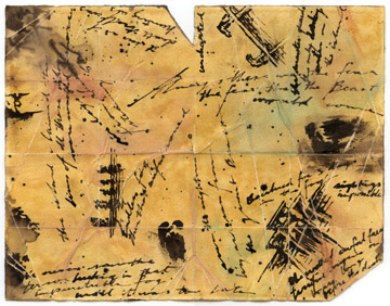
The reverse side of the hand-drawn map, covered in more barely legible hints and warnings about the dangers of the island, and a few drawn images. |
|
|
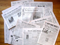
Newspapers for the 1930s. Two sets of 12 different newspapers - some broadsheet and some tabloid sized - were created by Daniel Reeve, in conjunction with the Wellington newspaper company. The sets had different dates and different news headlines and advertisements - one set for summer and the other set for winter, just before Christmas. |
|
|
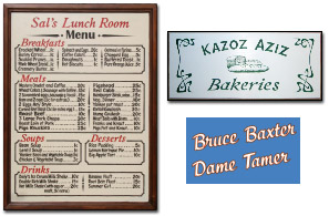
Various signs and pieces of lettering. The menu for the diner had to be altered at the last minute - Veg. Dinner (or was it Oxtail Goulash?) deleted and Macaroni Cheese (the meal Anne was eating) added! |
|
|
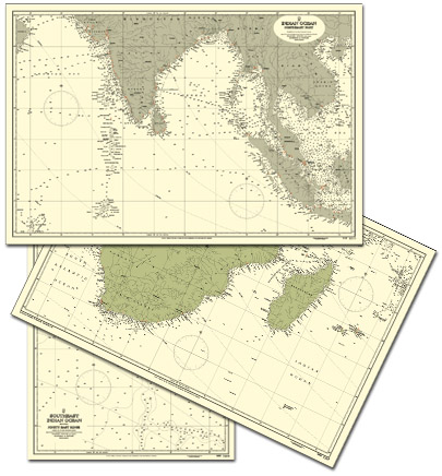
It is not possible to buy marine charts now, that show places like Ceylon (now Sri Lanka) and Siam (now Thailand), nor to track down - let alone use - real charts from the 1930s. So Daniel created marine charts in the appropriate style, from scratch. The two large charts show the Indian Ocean, east and west, while the third chart shows soundings in empty ocean, in the area where Skull Island in fact lies... |
|
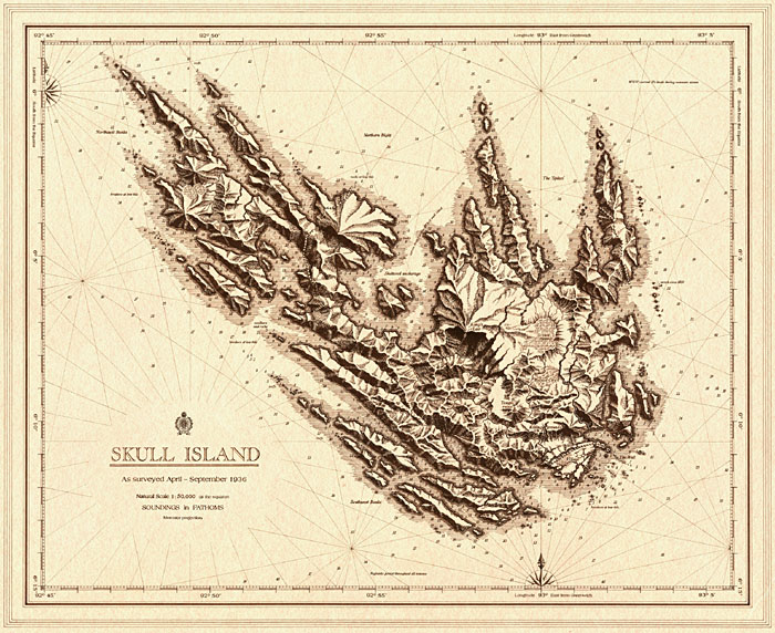
Daniel also created the map of Skull Island, shown below, which was used for merchandising and publicity.